Upgrade of our multispectral drone
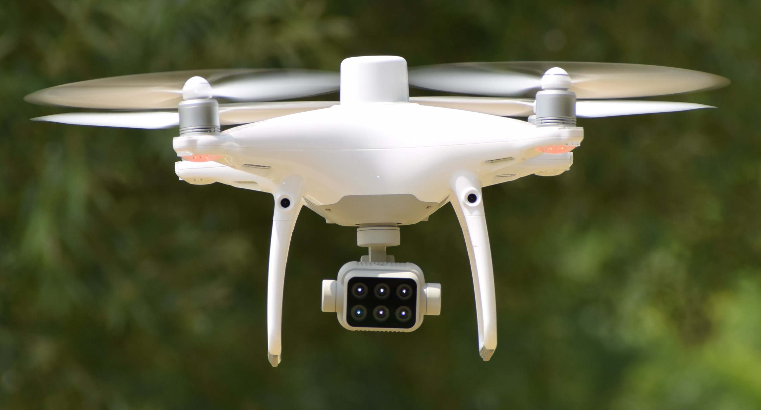
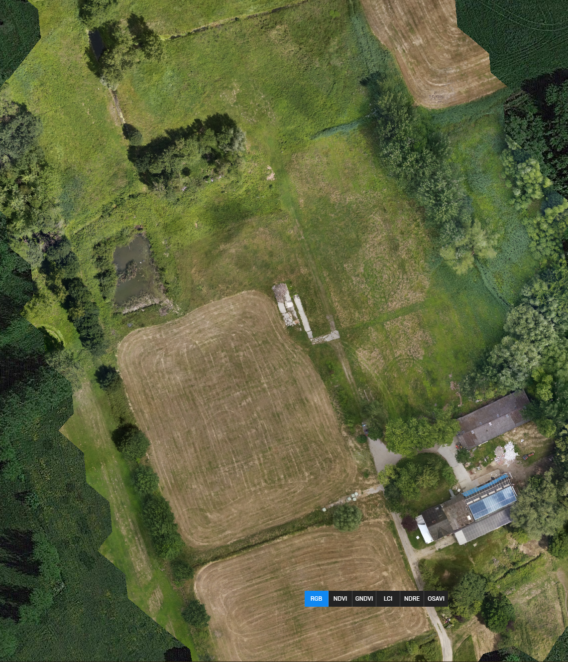
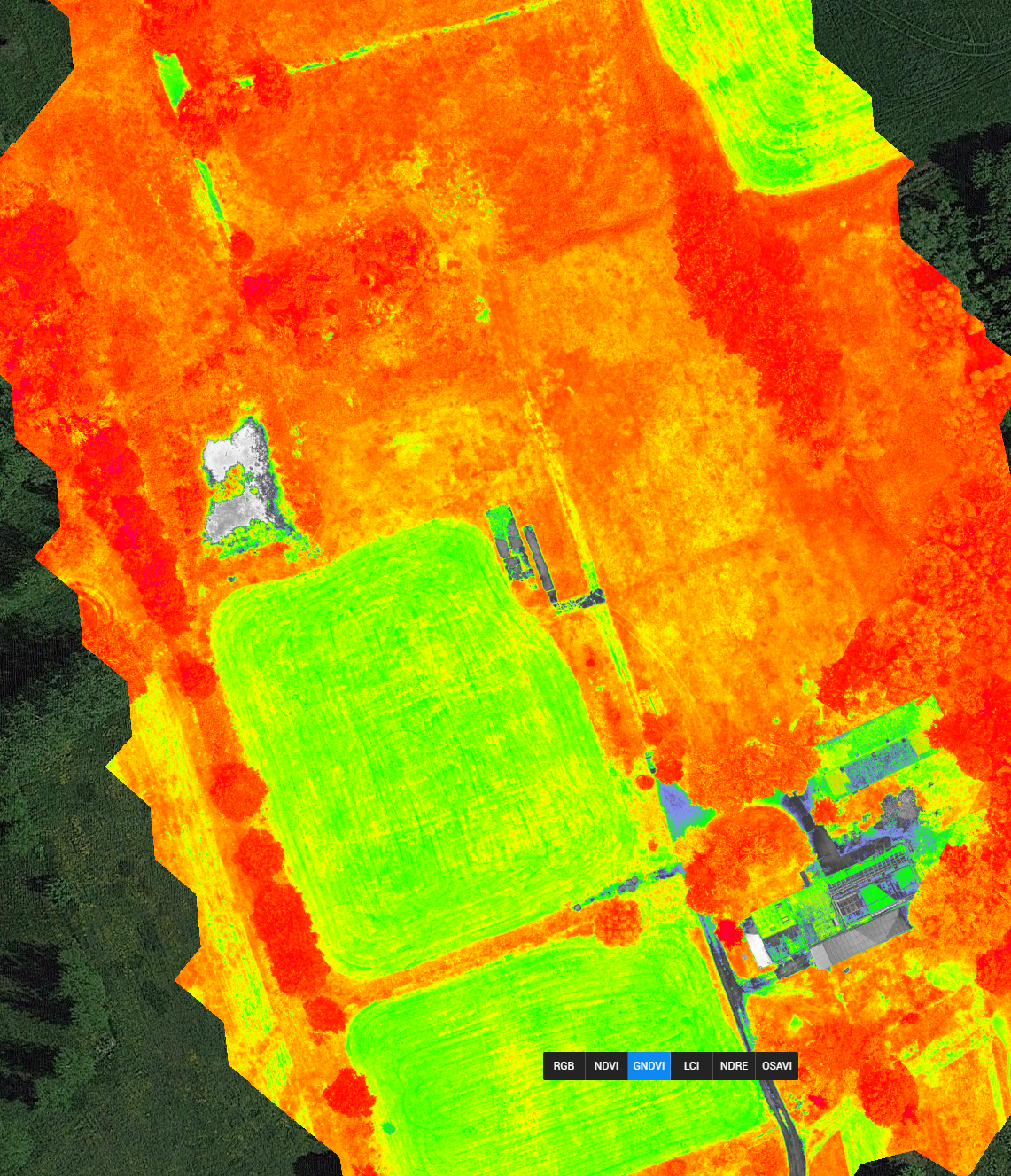
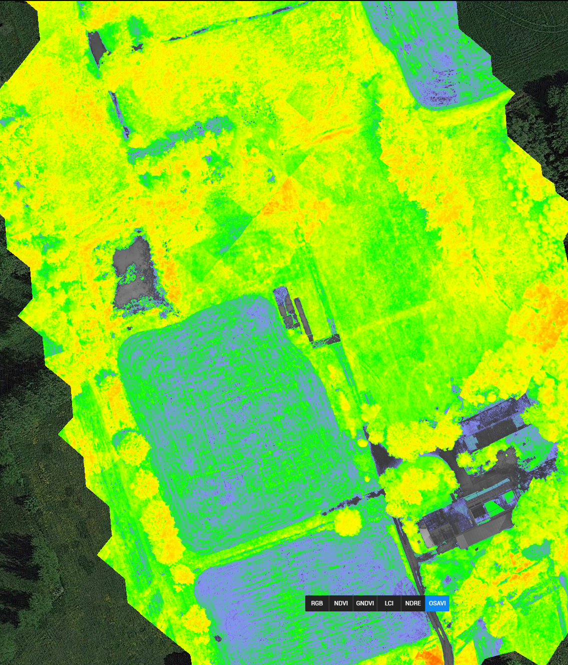
Since june 2022, Idris is using a new UAV (Unmanned Aircraft Vehicle) for digital mapping of fields. The P4 is an upgrade for our operations in the field. The device is more accurate, more user-friendly and offers more options.
If you would like to learn more about our drone operations or are considering field mapping to gain more insight into places of drought or stress in the field, please contact our drone pilot Stan Aelterman for more information (stan.aelterman@gmail.com).
The future of the land is in the air!