Crop scouting - Digital mapping
Since 2019, the Idris team is using drones to scan fields. Drones are an interesting solution in many professional fields, such as agri- and horticulture.
Drone solutions in general
Aerial photography has been around for many years but such projects were generally very expensive. To make aerial photographs of farms, buildings, roads or areas, a flight with a manned heli or fixed wing airplane was necessary. Nowadays, the unmanned aircraft system is a cost-effective solution for mapping every interesting object or subject.
What can we do for the grower/horticulturist?
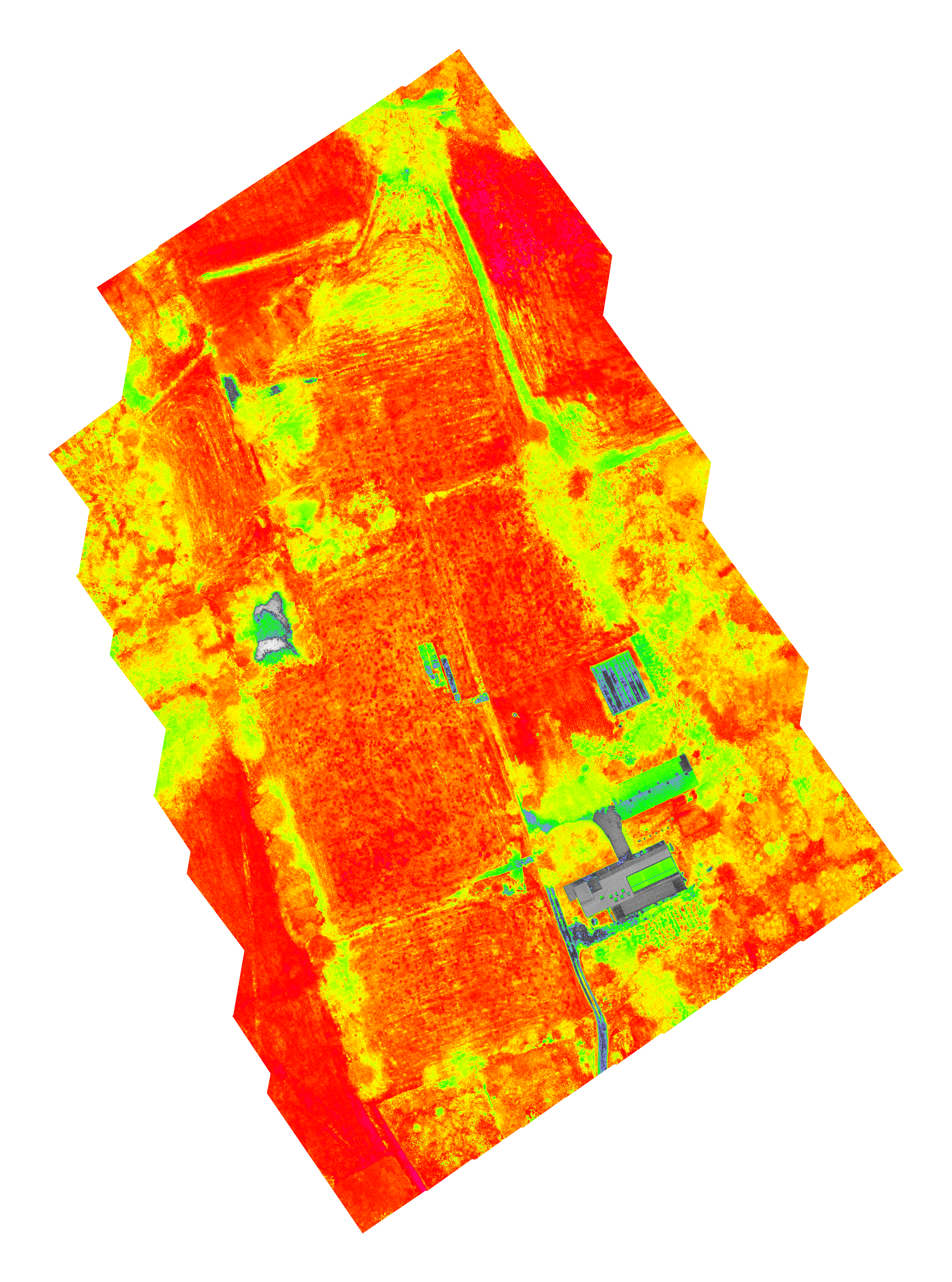
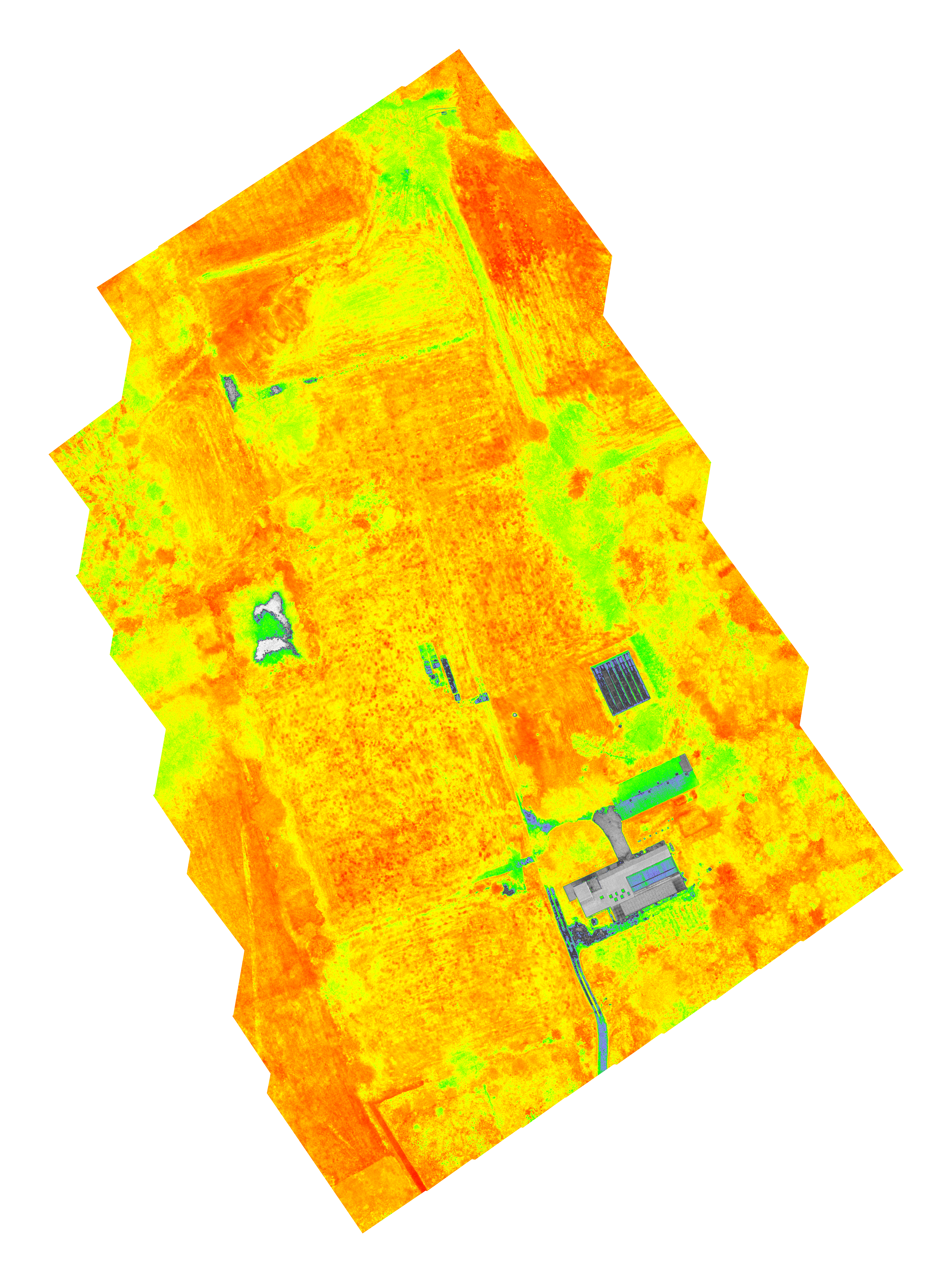
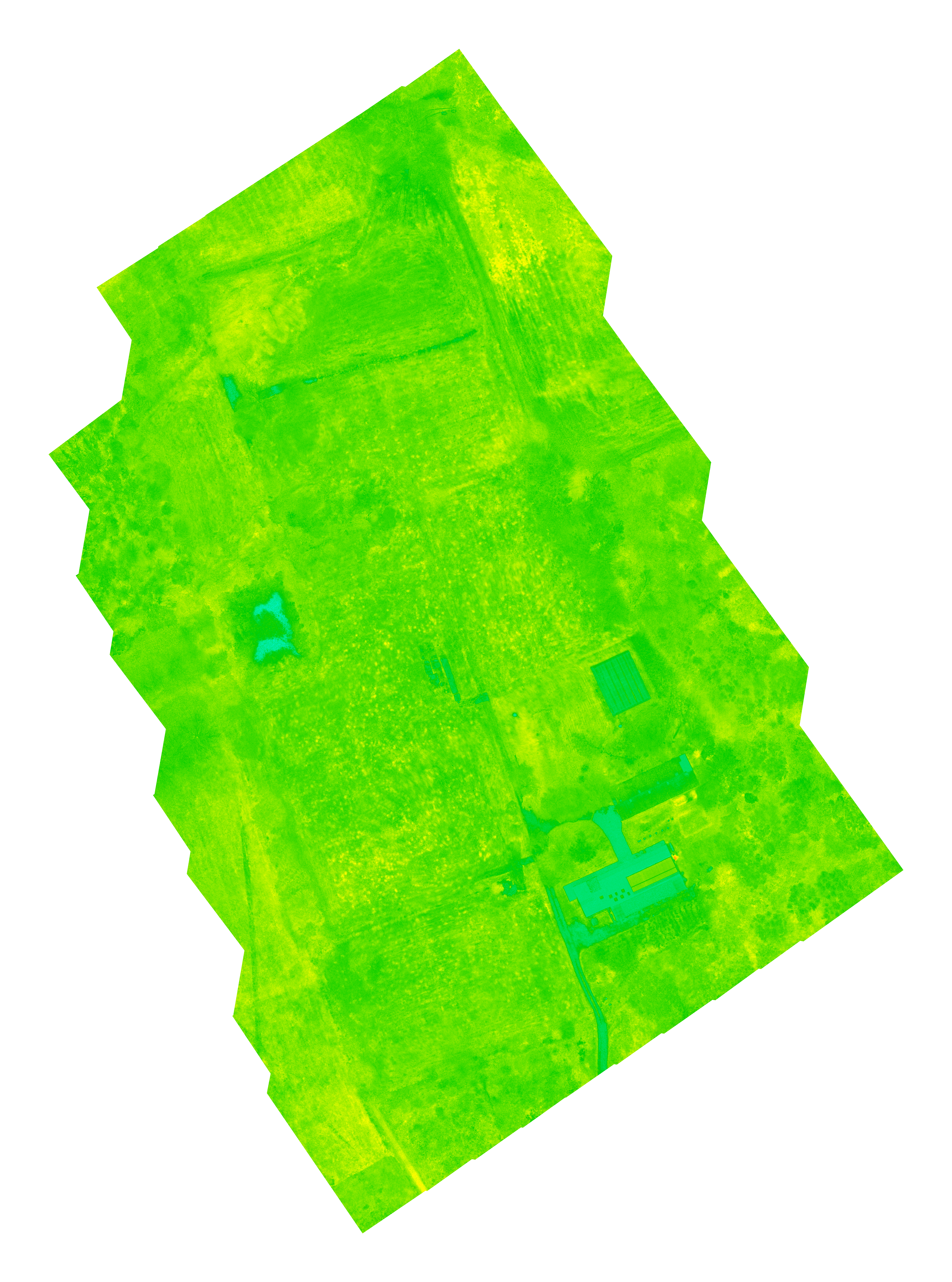
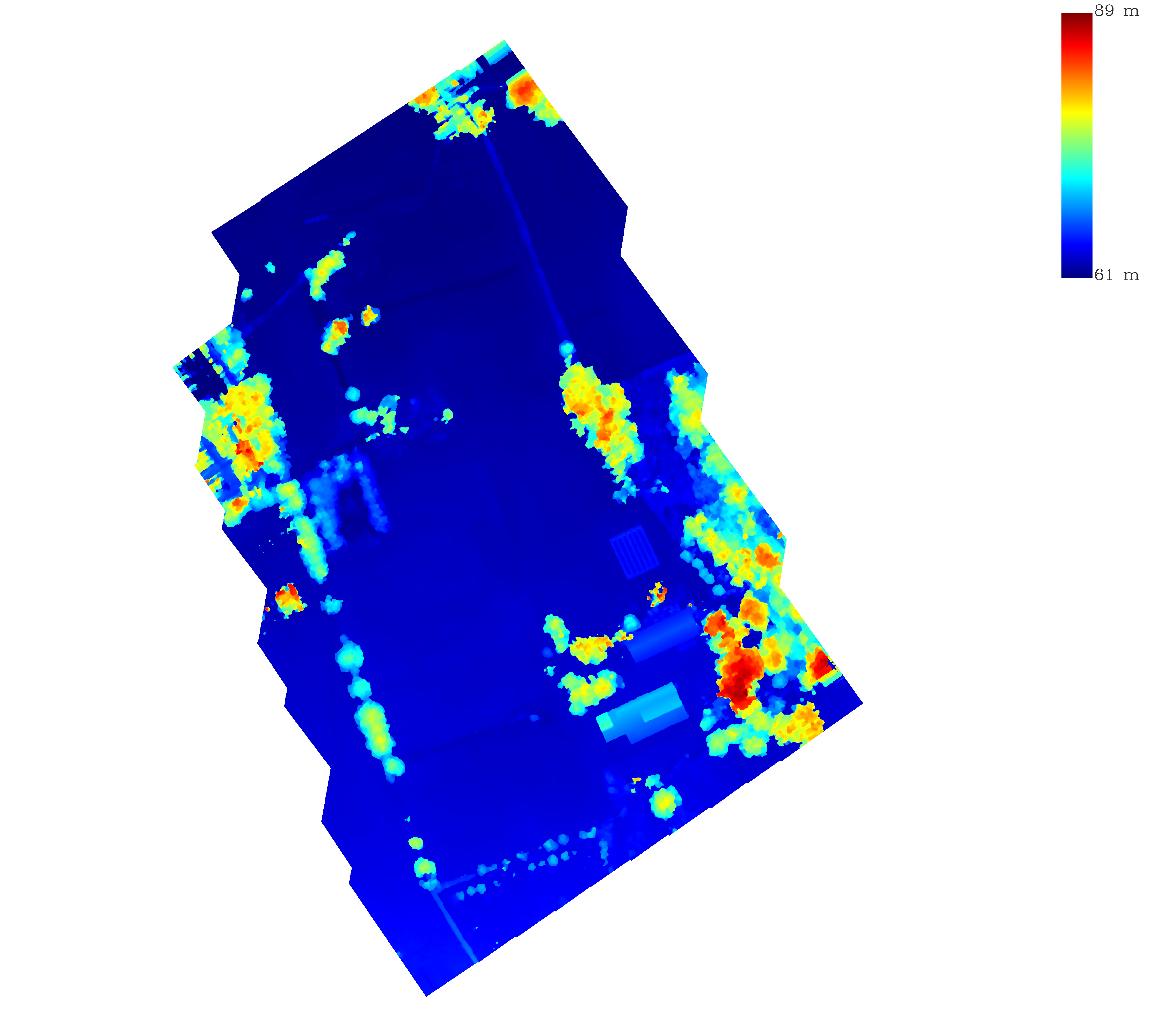
We can survey the field by taking pictures from above in different wavelengths. The photos are merged into an orthomosaic, so fields of several hectares can be mapped. In addition to the full visible light spectrum, images in green, red, red edge and near-infrared are possible. Images taken in a small wavelength band can provide a lot of information about the state of the field and crops, even elevation maps and 3D reconstructions are possible. The images below are examples of a scan of a farm where you can see several parameters.
First image is an easy mosaic in visual colors to give an idea, several grass fields, concrete, trees, greenhouses and water is visble.

Below: NDVI
GNDVI
LCI
NDRE

OSAVI

Elevation
For more information, you can contact our drone pilot stan.aelterman@gmail.com, having a EU pilot license.