See your fields like never before

See your fields like never before.
With our multispectral drone technology, we bring precision agriculture to the next level. By capturing light beyond what the human eye can see, we can analyze your crops’ condition in detail and create high-resolution orthomosaics that reveal variations in growth, health, and stress across your fields. The spatial resolution of the maps depends on the flight altitude, allowing for highly detailed scans when flying low.
Our analyses include key vegetation indices such as:
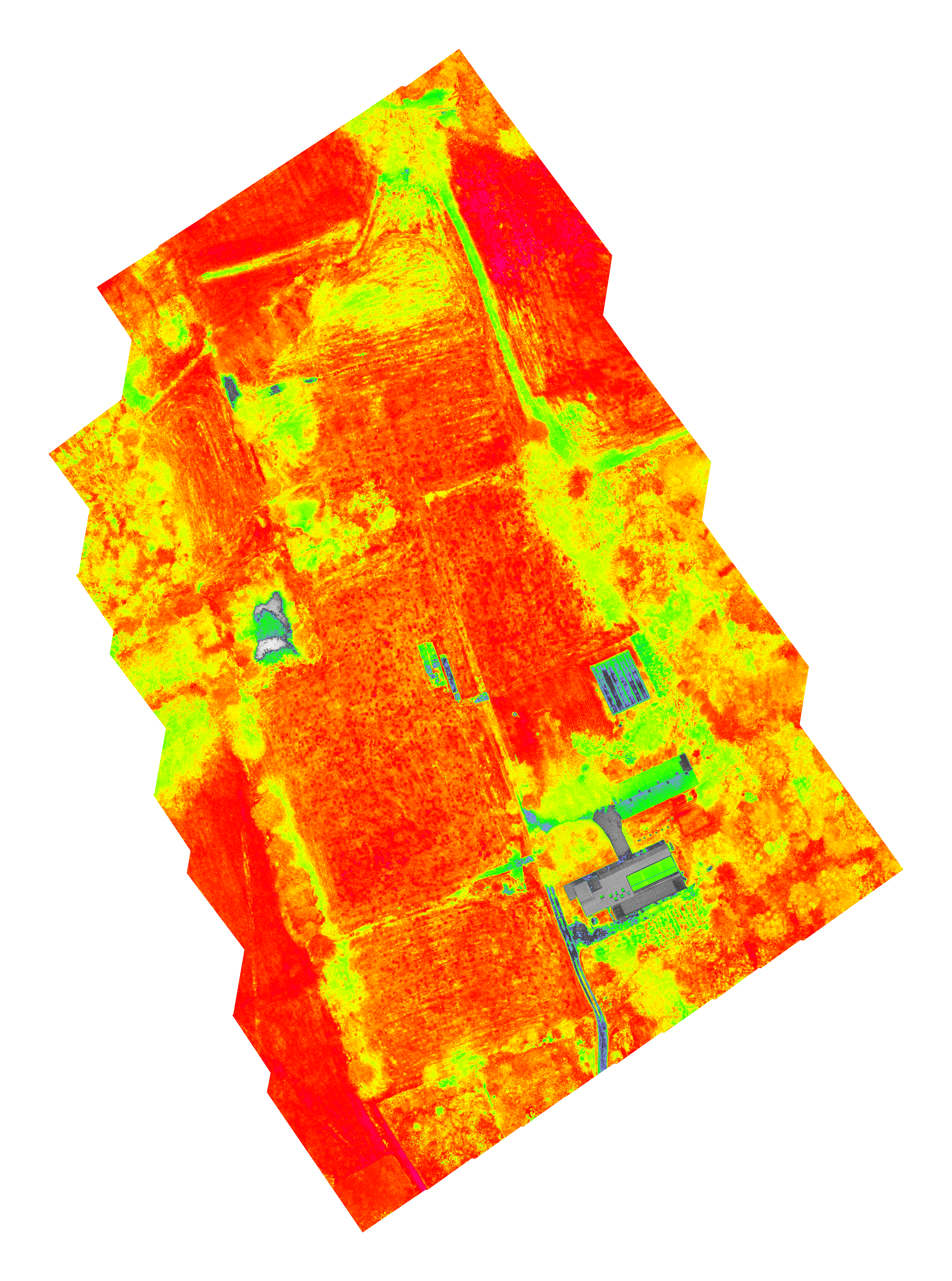
- NDVI (Normalized Difference Vegetation Index) – shows general plant health and vigor.
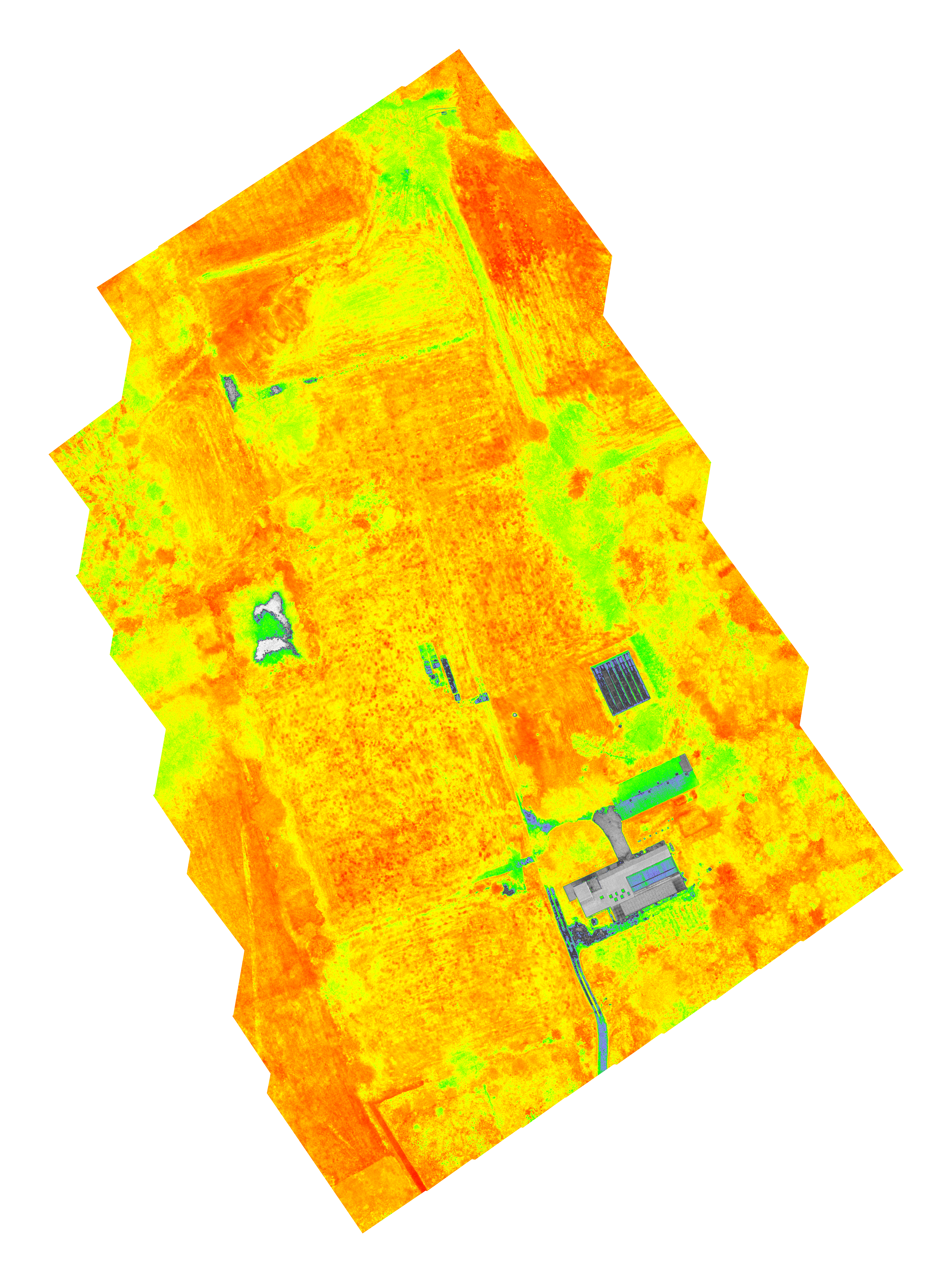
- GNDVI (Green NDVI) – focuses on chlorophyll content and nitrogen status.
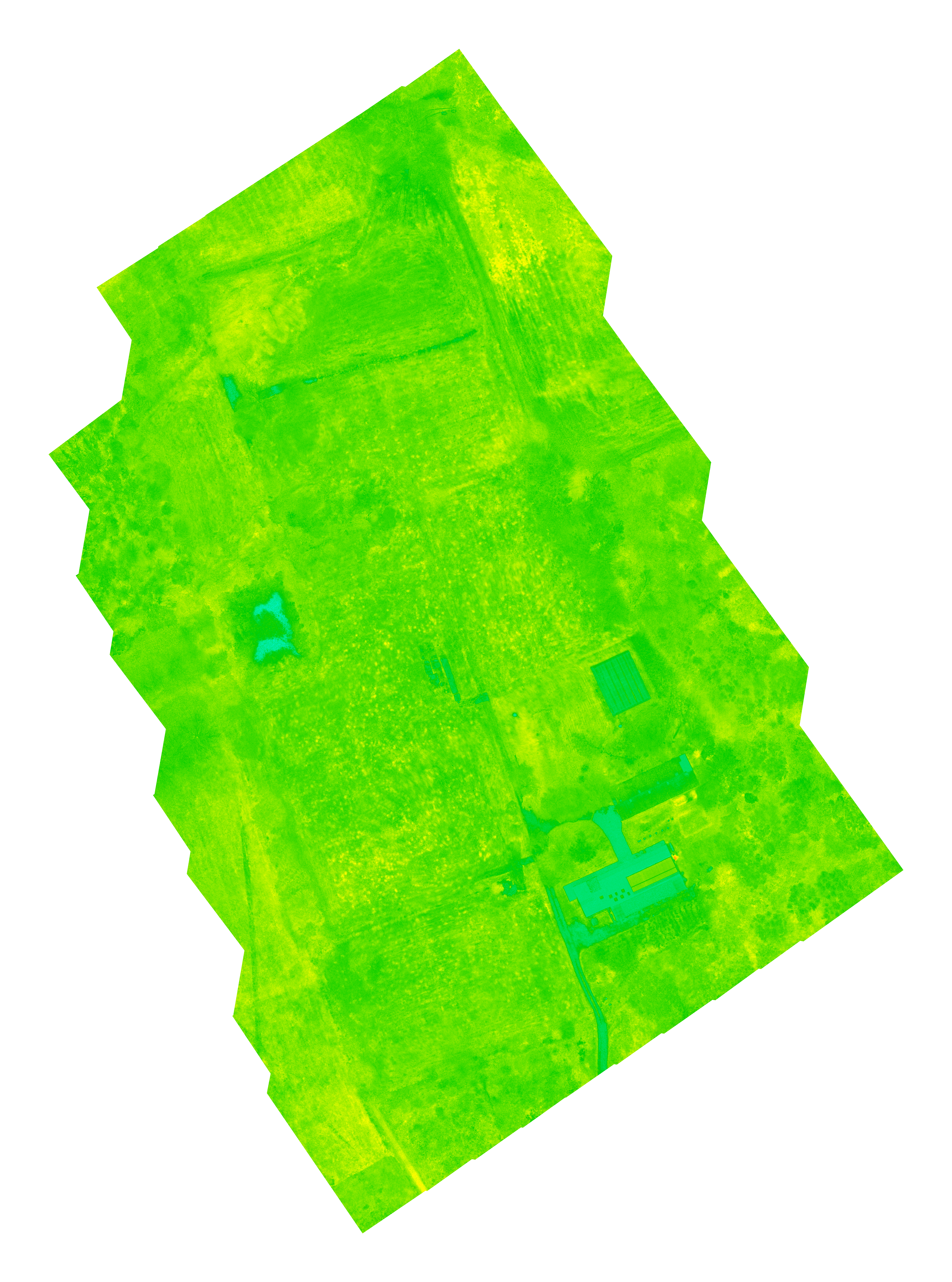
- LCI (Leaf Chlorophyll Index) – indicates the efficiency of photosynthesis.
- NDRE (Normalized Difference Red Edge) – helps detect stress before it’s visible to the naked eye.
- OSAVI (Optimized Soil-Adjusted Vegetation Index) – corrects for soil background, especially in early growth stages.
Together, these insights allow for smarter field management, from optimizing fertilizer use to detecting crop stress early — saving time, resources, and improving yields.
Below is an example scan captured near our own fields, showing how detailed and actionable the data can be.
Would you like to see your crops from a new perspective and make better-informed decisions?
Get in touch with us today to map and improve your fields, contact Stan (stan.aelterman@gmail.com) for more details.

Below: NDVI
GNDVI
LCI
NDRE

OSAVI

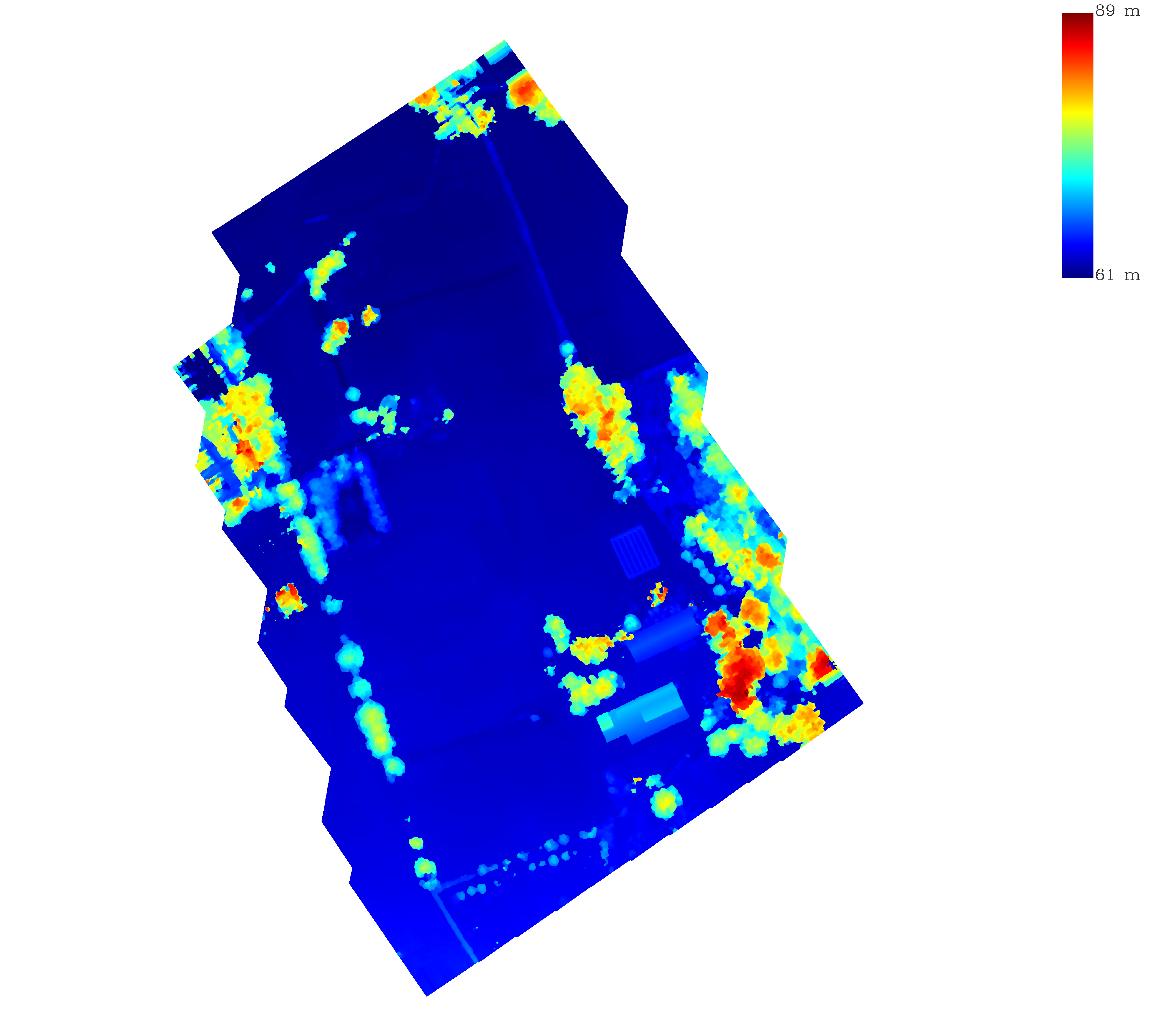
Elevation